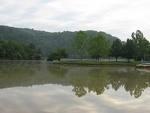
Beech Fork Lake Fishing Spot
- Elevation: 580'
- Last Modified By: vinny60 on 09/09/09 11:01 PM
- Ask about Beech Fork Lake in our Fishing Forums
Photos
Fish Species
Comments
-
Have you fished at Beech Fork Lake? Be the first to comment on this fishing spot.
Beech Fork Lake Baits and Tackle
Live Bait (Other) Check Prices
- Large Minnow cut bait
Beech Fork Lake Description
5 hp max mostly fished at damn area night crawlers minnows found to be best bait also good fishing in damn spill way best fished from boat
Beech Fork Reservoir is a 720 acre US Army Corps of Engineers flood control impoundment on Beech Fork and Millers Fork of Twelvepole Creek in Wayne County. The lake is located 9 miles south of Huntington near the town of Lavalette. Beech Fork is accessible from Huntington by State Route 152. The lake was constructed in 1978 by the US Army Corps of Engineers for flood control, recreation, and fish and wildlife. Boating is permitted however a 10 horsepower restriction is enforced at Beech Fork Lake. Camping is available at Beech Fork State Park located on Cabell County Route 43 and Wayne County Route 17 at the upper end the Beech Fork arm